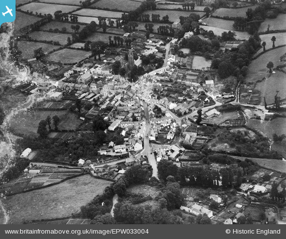
EPW033004 ENGLAND (1930). Bridge Street, St Andrew's Church and the town centre, Stratton, 1930
© Copyright OpenStreetMap contributors and licensed by the OpenStreetMap Foundation. 2024. Cartography is licensed as CC BY-SA.
Details
| Title | [EPW033004] Bridge Street, St Andrew's Church and the town centre, Stratton, 1930 |
| Reference | EPW033004 |
| Date | July-1930 |
| Link | |
| Place name | STRATTON |
| Parish | BUDE-STRATTON |
| District | |
| Country | ENGLAND |
| Easting / Northing | 223019, 106398 |
| Longitude / Latitude | -4.51339150167, 50.829463724688 |
| National Grid Reference | SS230064 |
Pins
 HdeB |
Tuesday 15th of March 2016 07:46:11 AM |


![[EPW033004] Bridge Street, St Andrew's Church and the town centre, Stratton, 1930](http://britainfromabove.org.uk/sites/all/libraries/aerofilms-images/public/100x100/EPW/033/EPW033004.jpg)
![[EPW033005] The town, Stratton, 1930](http://britainfromabove.org.uk/sites/all/libraries/aerofilms-images/public/100x100/EPW/033/EPW033005.jpg)
![[EPW033003] Maiden Street, St Andrew's Church and the town centre, Stratton, 1930](http://britainfromabove.org.uk/sites/all/libraries/aerofilms-images/public/100x100/EPW/033/EPW033003.jpg)


