
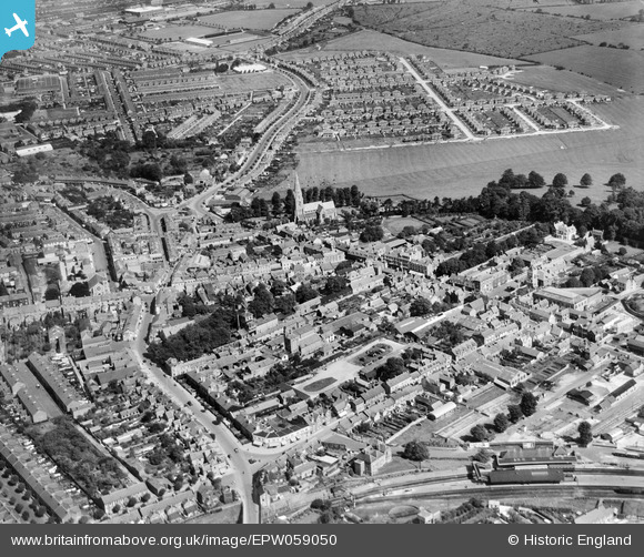
EPW059050 ENGLAND (1938). Old Town, Swindon, 1938
© Copyright OpenStreetMap contributors and licensed by the OpenStreetMap Foundation. 2024. Cartography is licensed as CC BY-SA.
Nearby Images (5)
EPW059050

EPW010119

EPW010117

EPW059048

EPW010112

Details
| Title | [EPW059050] Old Town, Swindon, 1938 |
| Reference | EPW059050 |
| Date | 30-August-1938 |
| Link | |
| Place name | SWINDON |
| Parish | |
| District | |
| Country | ENGLAND |
| Easting / Northing | 415702, 183757 |
| Longitude / Latitude | -1.7735082066634, 51.552005067745 |
| National Grid Reference | SU157838 |
Pins
 Gary |
Tuesday 16th of January 2024 04:42:50 PM | |
Gary |
Tuesday 16th of January 2024 04:42:05 PM | |
NottmJas |
Saturday 16th of September 2023 11:44:53 PM | |
NottmJas |
Saturday 16th of September 2023 11:35:31 PM | |
NottmJas |
Saturday 16th of September 2023 11:32:56 PM | |
NottmJas |
Monday 2nd of May 2022 09:50:57 PM | |
NottmJas |
Monday 2nd of May 2022 09:48:37 PM | |
gBr |
Monday 11th of March 2019 09:31:29 PM | |
gBr |
Monday 11th of March 2019 09:29:38 PM | |
kingcole |
Sunday 25th of August 2013 03:58:47 PM | |
Isleworth1961 |
Wednesday 12th of June 2013 09:42:09 AM |


